Case study on urban fragmentation in Marseille
Case study on urban fragmentation in Marseille (January - February 2026)
Introduction and context
I based this case study on an in situ exploration of Marseille on January 18, 2026. It serves as a journey through the Phocaean city's urban complexity. My goal was to document the city's striking contrasts and observable inequalities. Using photography, I am able to capture quality of life indicators and witness social fractures. The following excerpts offer a critical reading of these changing spaces.
Rue de Lyon: an interface under tension between industrial heritage, degraded housing, and urban renewal
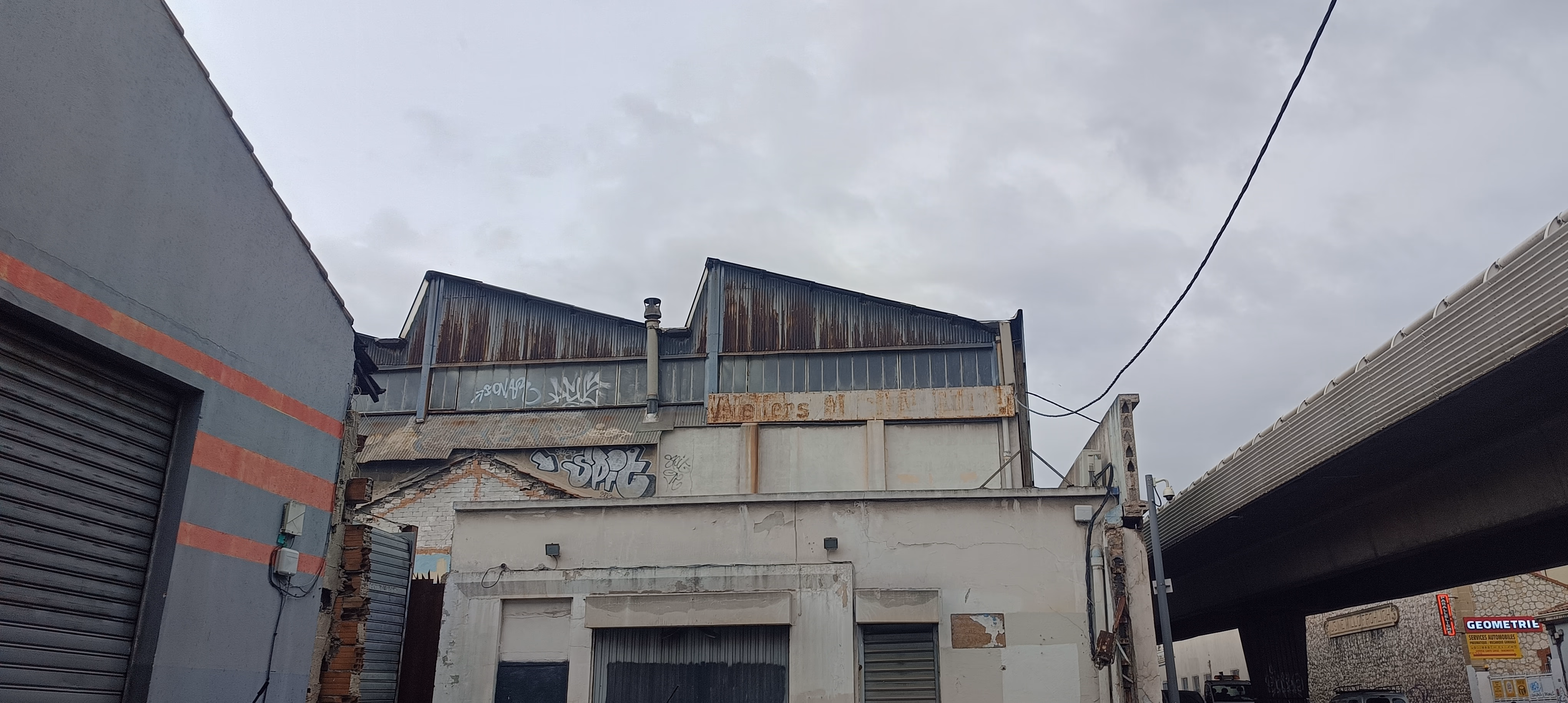
Rue de Lyon, the north-south backbone of the Northern Districts (Quartiers Nord), illustrates Marseille's contradictions perfectly. It sits between large housing estates (including the Campagne-l'Évêque slab block) and the Saint-Louis ZAC, a historic industrial fabric currently undergoing renewal. Further south, the Saint-Louis sugar refinery and François Billoux Park (home to the sector's town hall) dominate the landscape.
The Saint-Louis sugar refinery in the distance
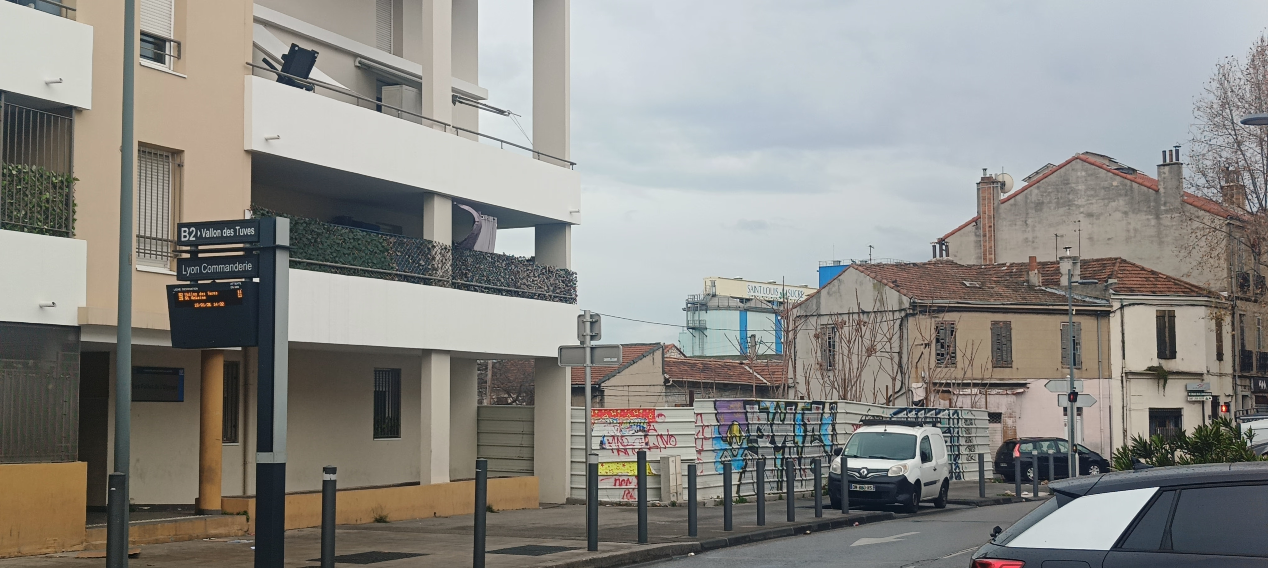
Four hundred meters from this viewpoint lies the Gèze Multimodal Exchange Hub (see section Gèze Metro). This working-class area is changing fast, structured by the arrival of the B2 BRT, which links the Metro terminus (Line 2), the Saint-Antoine train station, and Hôpital Nord, a major metropolitan facility.

Insertion of a recent building at the intersection with Chemin de la Commanderie
Although new real estate projects pop up sporadically, the neighborhood suffers from brutal heterogeneity. You can see preserved ancient village cores right next to unworthy or highly degraded housing. In the background, the Campagne-l'Évêque estate looms over the landscape, a reminder of the security and trafficking issues that socially isolate these territories despite their physical openness.
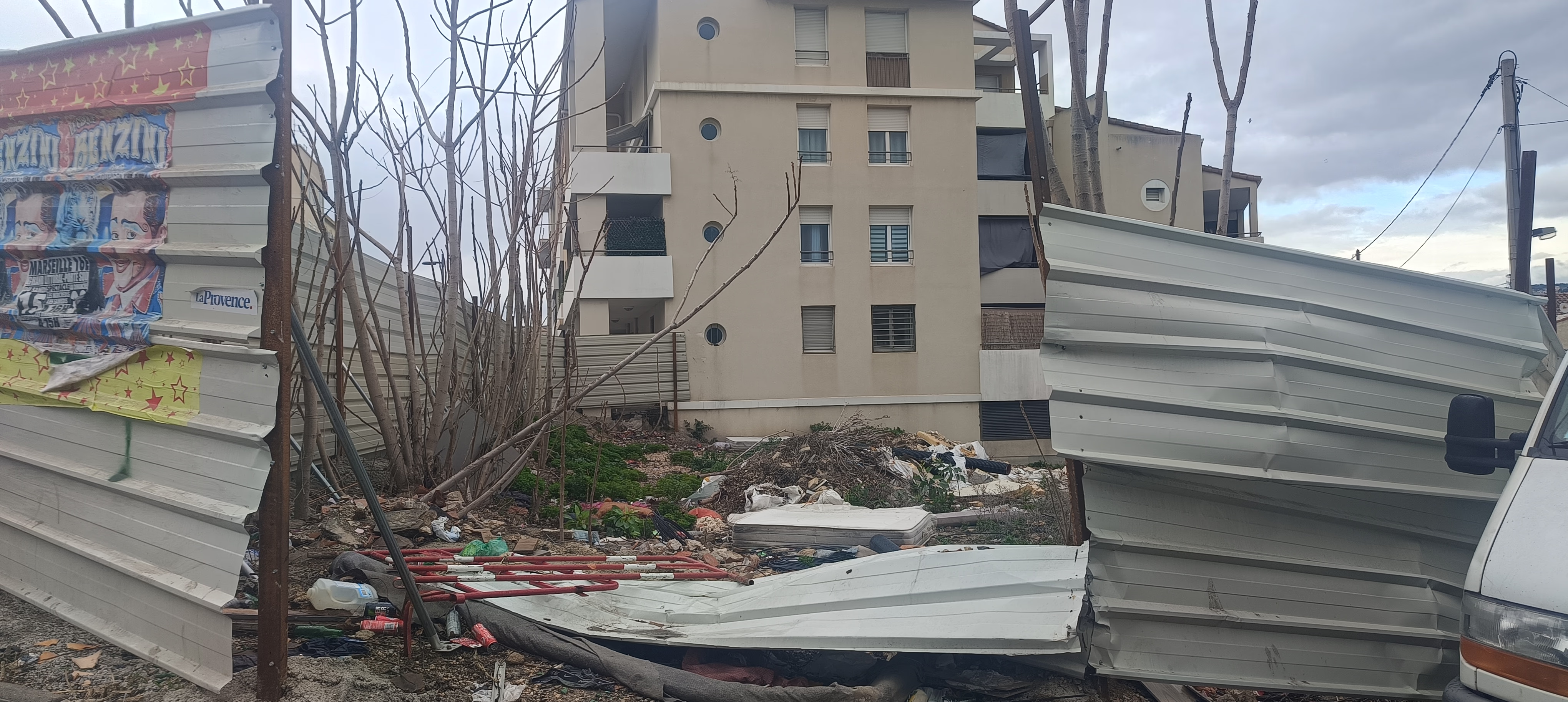
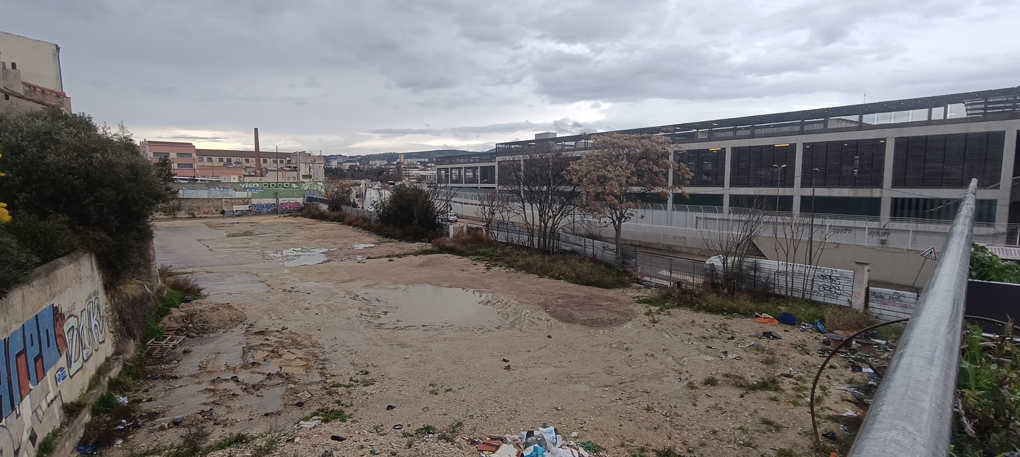
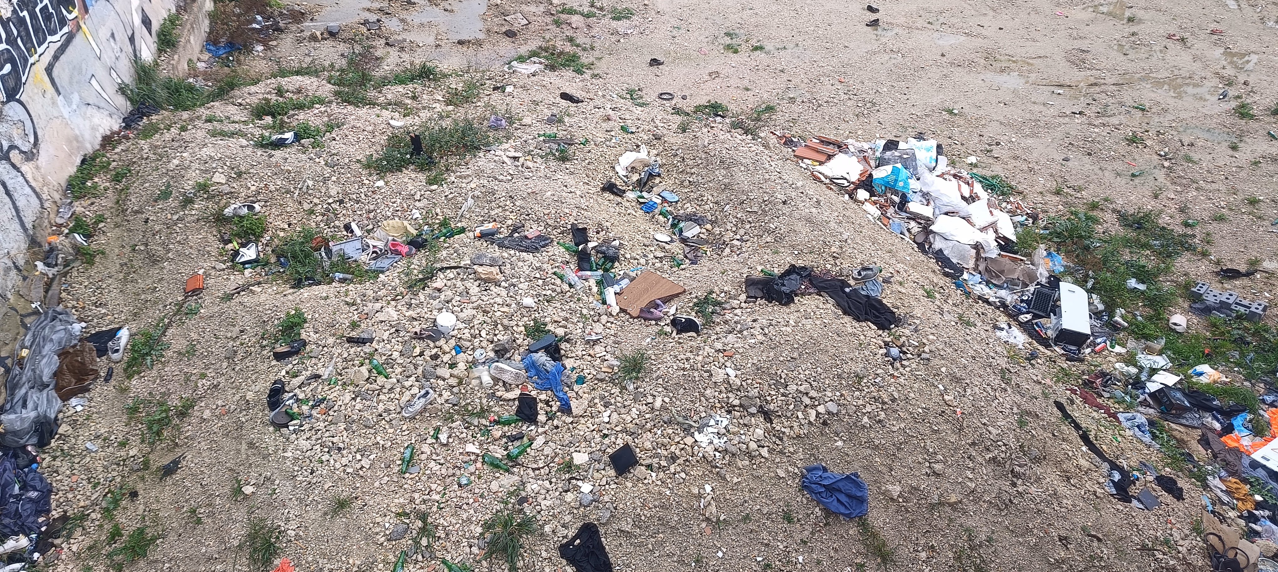
Urban neglect: a halted construction site transformed into an illegal dumping ground
Field observation reveals the gap between the stated ambitions of urban renewal (Euroméditerranée 2 extending northward) and the reality of urban decay. These brownfields, turned into open-air landfills, show a failure in public space management and chronic under-investment. They materialize an urban fracture that struggles to heal.
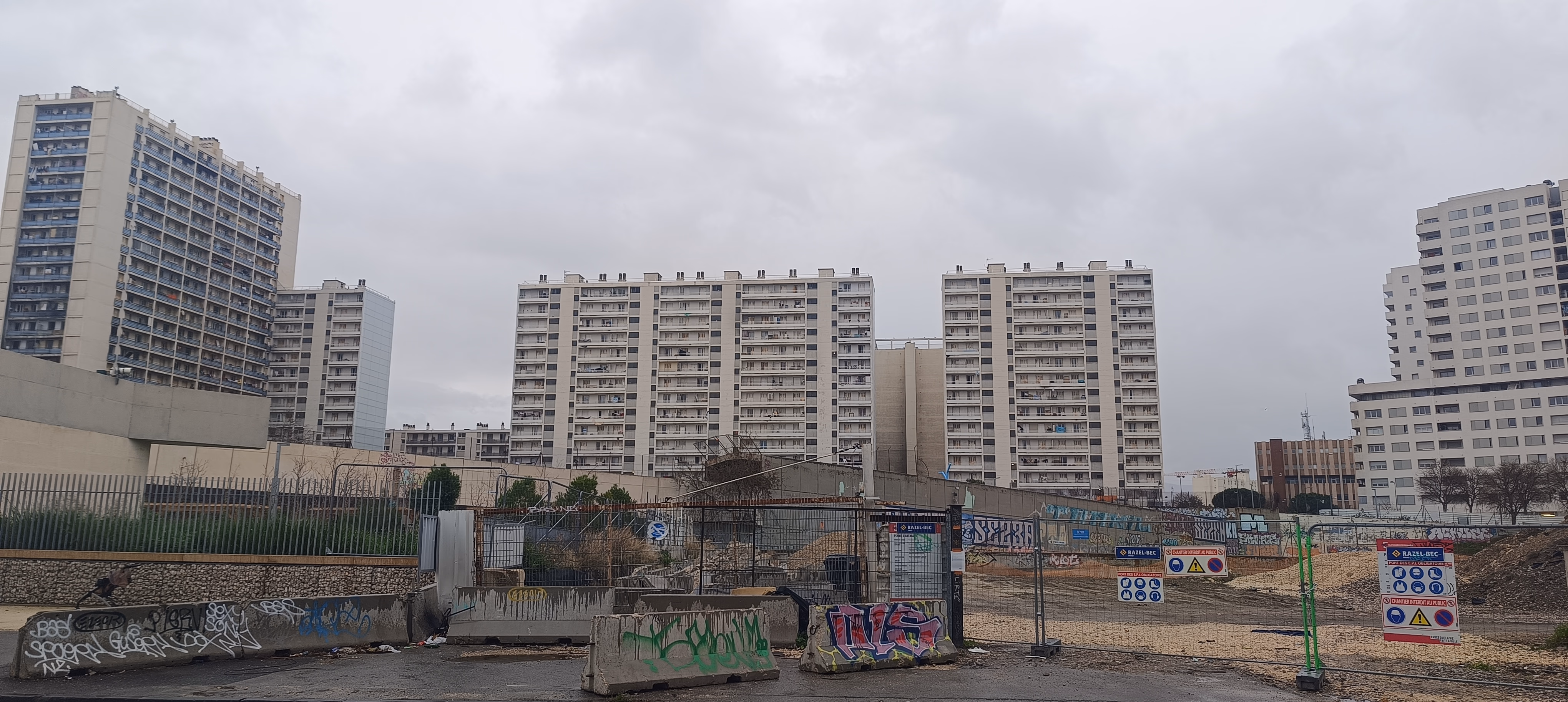
Gèze: hyper-connectivity vs. urban fracture
Opened in December 2019 after a long series of technical delays, the Gèze station was supposed to mark the renewal of the Northern Districts (La Cabucelle, Les Crottes, Les Arnavaux). Located just up from Rue de Lyon, this transport interface recently changed scale with the launch of the T3 tramway (January 2026) and the B4 BRT (September 2025).
South perspective: the pedestrian junction between the metro forecourt and the new tramway station
Now a Multimodal Exchange Hub (PEM), the site tries to drive a "dense city" dynamic, illustrated by new structural facilities (RTE regional headquarters) and commercial spaces. However, the ripple effect remains localized. Right next to these modern showcases, the urban fabric remains pockmarked by gap sites (dents creuses) and plots waiting for renewal, creating a landscape of violent contrasts.
North perspective: brownfields border heavy transport infrastructure
Analyzing this transport node raises a critical question about metropolitan networking strategy. Layering the T3 tramway onto a corridor already served by Metro Line 2 looks like infrastructure redundancy, while other territories in Marseille suffer from chronic isolation. The abundance of transport options here contrasts with the poverty of the surrounding public space.
Beyond the infrastructure, the sector's "walkability" shows major flaws. The northern section of the hub, still marked by construction, presents a total illegibility of flows. Pedestrians face broken pathways and conflicts with car traffic—a symptom of planning where the technical object (the metro/tram) took precedence over urban stitching and user experience.
Le Merlan: socio-spatial fragmentation and urban archipelago
Residential enclosure is key to understanding Marseille's current morphology. This phenomenon, described as an "archipelago city", has been widely documented by researchers Julien Dario and Élisabeth Dorier (Aix-Marseille University). The Merlan sector offers a striking cross-section of this dynamic: direct friction between secured middle-class condominiums (Florida and Parc Bellevue) and Large Housing Projects (QPV) like La Busserine or Font-Vert. One of the most dilapidated condominiums in France, Parc Corot, is also nearby.
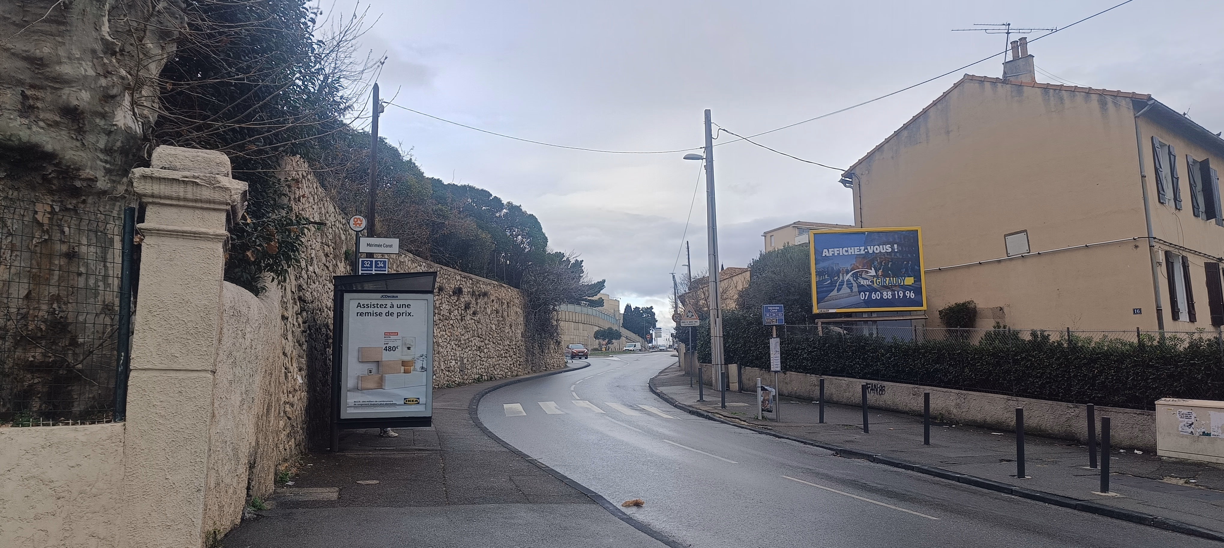
The Mérimée Corot bus stop, a contact point between metropolitan flows and residential withdrawal
At the interface of the Merlan shopping center and the surrounding estates, the Mérimée Corot bus stop illustrates a paradoxical accessibility. Although the node has a dense transport offer (lines 32, 34, 53 by day, 533 in the evening, and N2 at night), the immediate environment is hostile to pedestrians. The road network here is constrained by the defensive morphology of the riparian blocks.
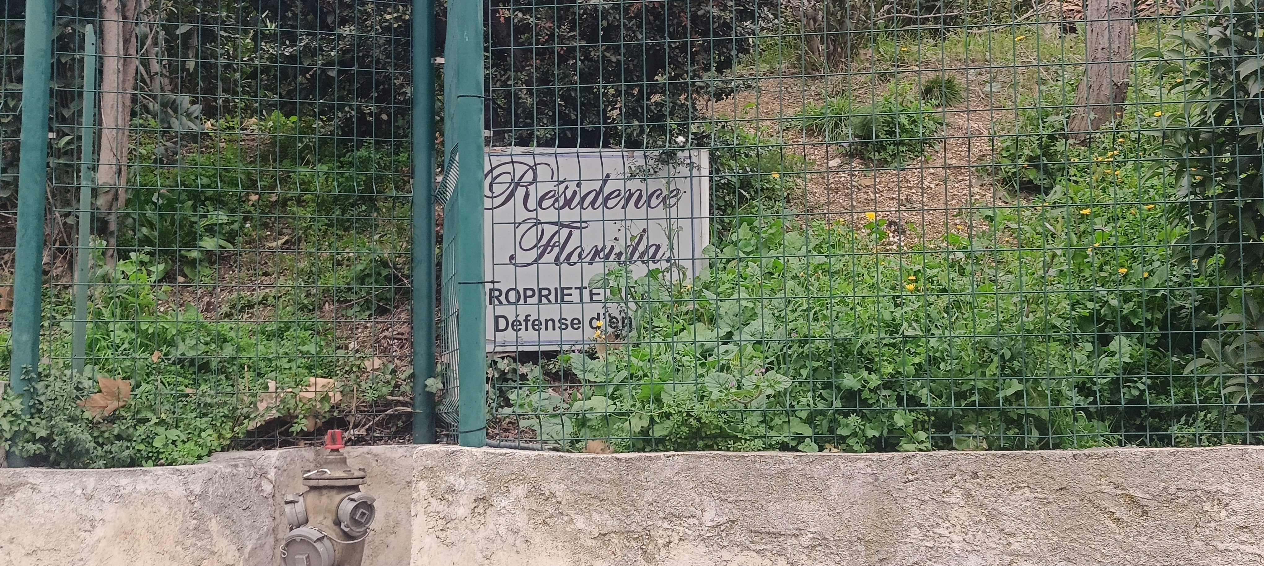
The Florida Residence: an architecture of enclosure

The Parc Bellevue Residence: materialization of the border via fences and gates
The multiplication of these enclosures (here, Le Florida and Parc Bellevue) actively contributes to the socio-spatial fragmentation of the city. As theorized by Jane Jacobs in The Death and Life of Great American Cities, urban safety relies on diversity and visual interactions: "There must be eyes upon the street, eyes belonging to those we might call the natural proprietors of the street."
However, by erecting blind walls and fences, these residences suppress these "eyes on the street." They create "border vacuums" which, paradoxically, increase the feeling of insecurity outside the enclosure.
This fragmentation poses a major urban planning problem: the loss of the city's permeability. The pedestrian is forced into detours, social mixing is physically blocked, and the city becomes a juxtaposition of private enclaves. The answer to urban ills isn't secession; it must involve "urban stitching," opening up enclaves, and ensuring the continuity of public space, as suggested by the work of AGAM and Elisabeth Dorier.
Plombières: the stigma of "car-centric" policy
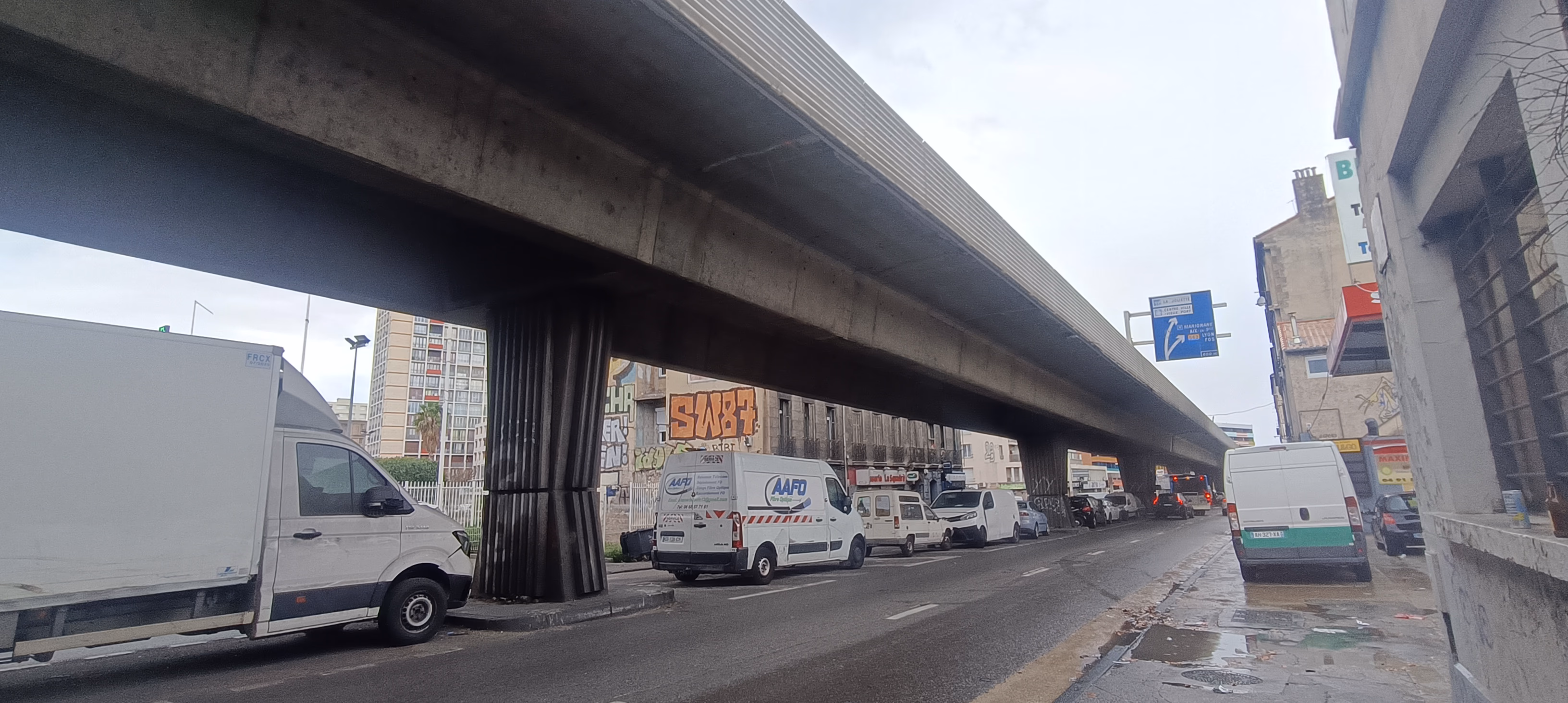
The Plombières Viaduct is a perfect product of automobile dominated architecture
The Plombières neighborhood (3rd arrondissement) is the physical embodiment of post-war "car-centric" policy. The viaduct, part of the first Marseille bypass (the Jarret), crushes the landscape. This brutal infrastructure sacrifices local quality of life for commuter transit flows, with over 50,000 vehicles passing daily on the viaduct alone. This political choice created a major urban break, plunging the boulevard below into chronic darkness and pollution, and freezing the neighborhood as a mere "corridor" for entering the city. Residents also suffer from incessant noise, largely exceeding legal limits of 68 dB, with rates reaching 76 dB.
Roof of the IslaStore shop. A wholesale commercial fabric surviving in the interstices of the road network
Excluded from the Euroméditerranée renovation dynamics, Plombières suffers a double penalty: isolation and pauperization. The buildings, blackened by exhaust fumes, house a survival economy or wholesalers, typical of neglected urban zones. Commercial vacancy here is a direct symptom of an environment made hostile by constant traffic.
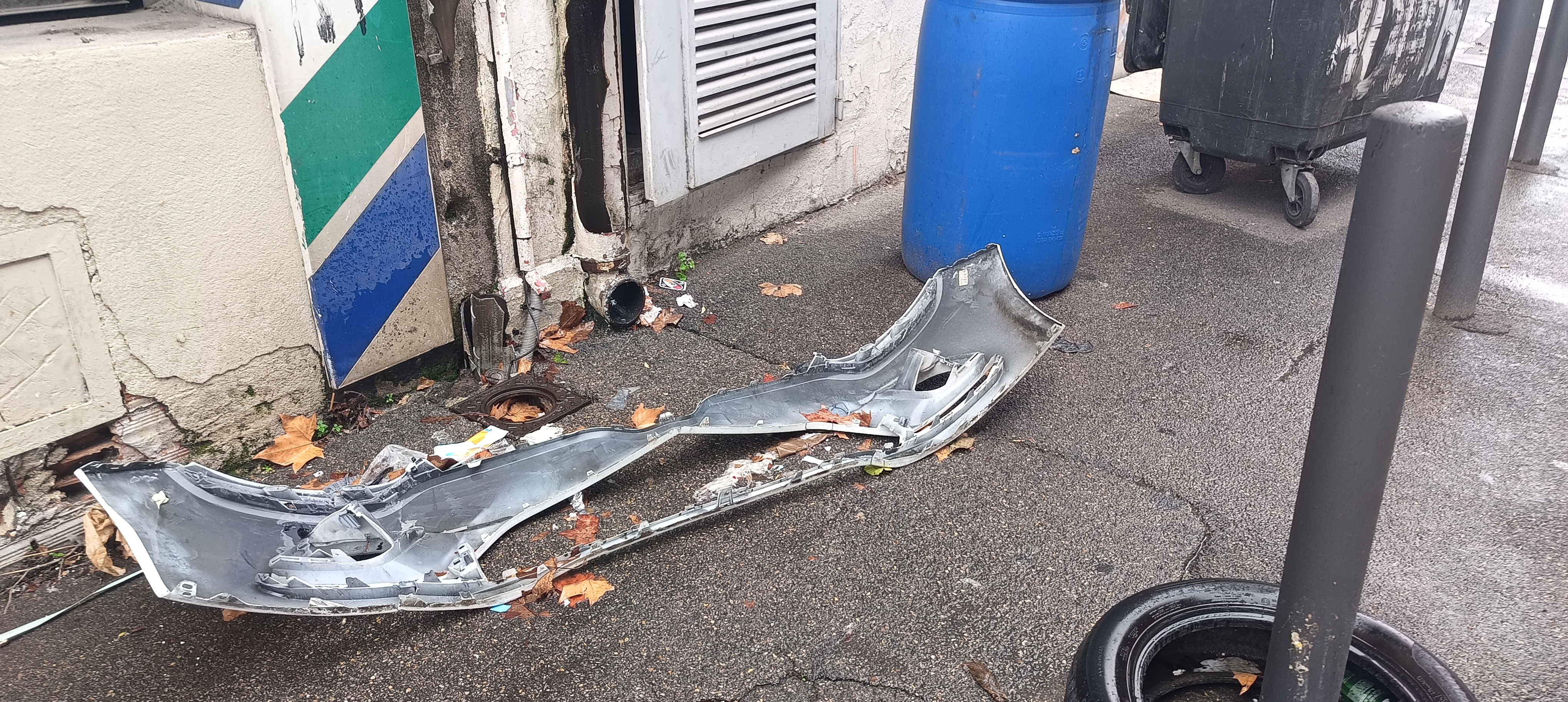
A bumper on the sidewalk: when the automobile colonizes even pedestrian space as waste
Walking in Plombières is an ordeal. My journey was blocked by automotive waste (bumpers, barrels) abandoned right on the sidewalk. This image is symbolic: the car isn't content with the roadway; it spills over into pedestrian space. For a Person with Reduced Mobility (PRM), the neighborhood is entirely inaccessible. The city here is designed exclusively for able-bodied, motorized people.
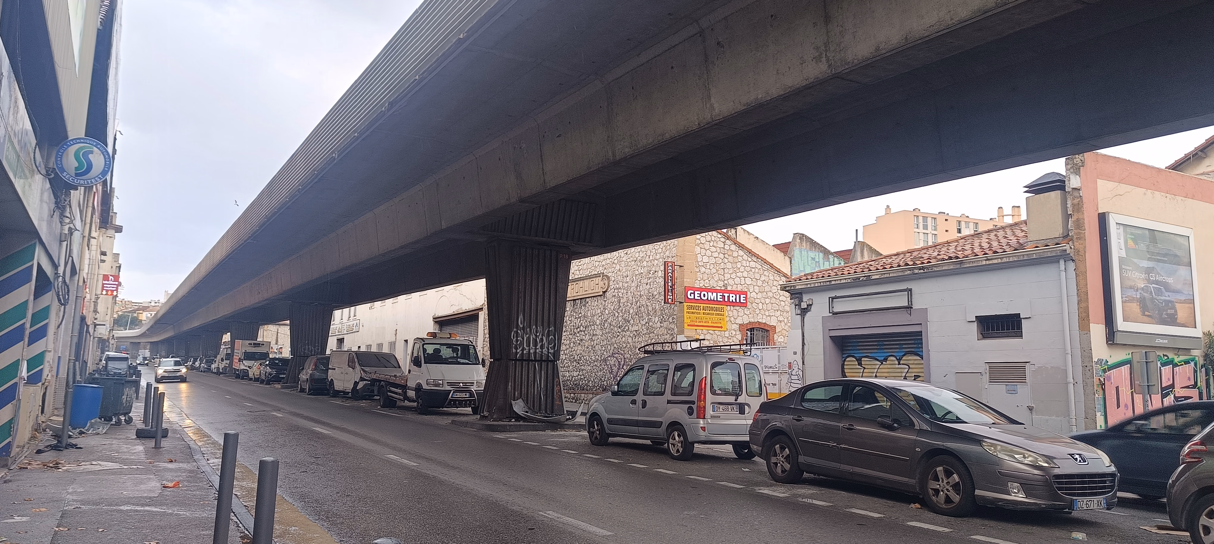
Under the viaduct, public space is confiscated by unregulated parking
The space under the viaduct is a "non-place," saturated by anarchic parking that obscures visibility and makes crossings dangerous—especially since pedestrian crossings are rare.
To exit this obsolete model, we can imagine a radical reconversion of the infrastructure. The viaduct, a symbol of automobile hegemony, could support a new mobility: an elevated metro or another ERW (Exclusive Right of Way transit), such as a tramway or light rail, linking Plombières to Saint-Just. Turning this "urban highway" into a transit bypass would stitch the fabric back together and finally return the ground to the inhabitants. We could then rehabilitate the ground level with green spaces.
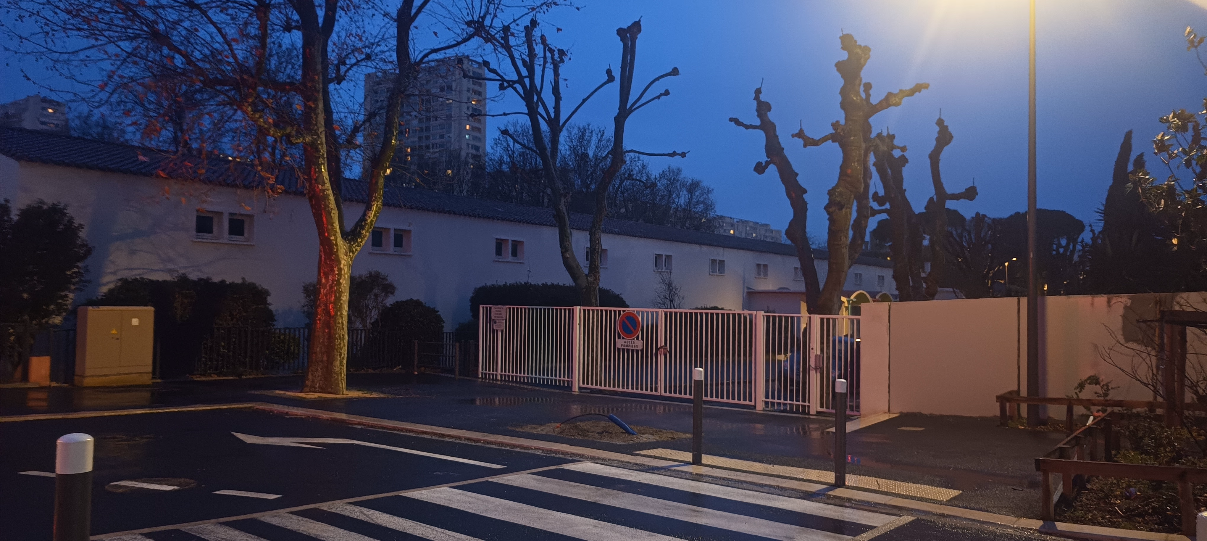
Parc Bougainville: between success and persistent construction

View of the entrance to Parc Bougainville
This park is part of the future Parc des Aygalades, an urban renewal program replacing the Canet freight station with a large "green lung" akin to a Marseillais Central Park that fits fully within the Euroméditerranée framework.
View of the construction site for the second part of Parc Bougainville
Near the Bougainville metro station, Parc Bougainville was built to allow the renaturalization of this northern district. However, results so far are mixed. While the first sequence (2 hectares out of 4) opened in February 2024, the second part of works remains, in January 2026, a closed-off construction zone. Ecological and pedestrian continuity stumbles on earthwork embankments and material stocks, creating a physical border where the park was supposed to stitch the neighborhood back together.
Another angle on the construction site of the second part of Parc Bougainville
This situation illustrates the struggle to manage urban timeframes in Marseille. The persistence of these "long construction sites" wears residents down. Beyond the technical delay, the quality of transitional arrangements is questionable: opaque fencing, degraded pedestrian paths, and a feeling of abandonment right next to a new facility. The city is transforming, but the construction phase remains a time of "suffering" for the surrounding public space.
The Arenc viaduct and the city's flip side
View of illegal dumping near the Arenc Viaduct
This shot captures a striking paradox. We are here in the heart of Arenc, the economic showcase of Euroméditerranée, an area in full mutation served by the new T3 tramway. Yet, the immediate surroundings of the motorway viaduct escape this requalification. These interstitial spaces, or "infrastructural leftovers," become receptacles for recurring illegal dumping. This phenomenon highlights the difficulty of urban management in friction zones, revealing the gritty "backstage" of metropolization.
Saint-Barnabé: the village in the city
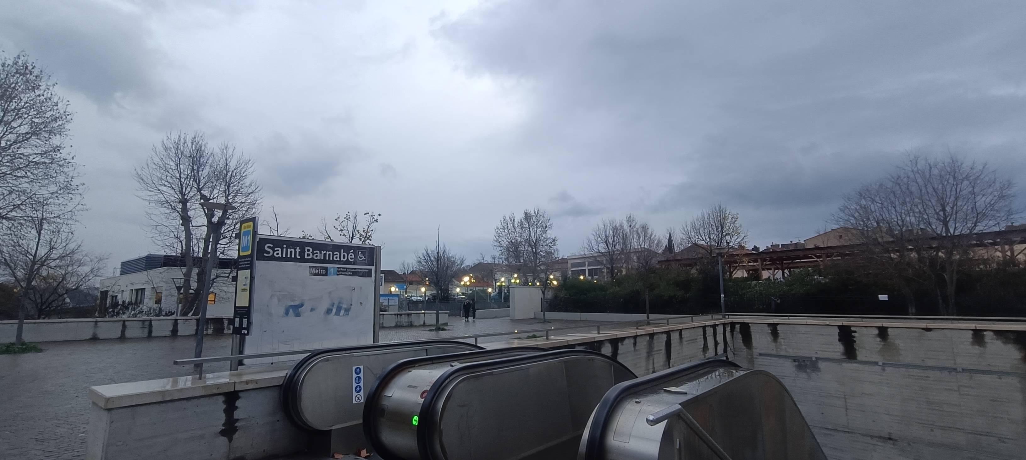
View of the main access to the Saint-Barnabé metro
The Saint-Barnabé metro station, in the east of the city, offers a striking contrast to Gèze. Located in an ancient village core, on the church square, the station fosters social bonding without the nuisances of major roads.
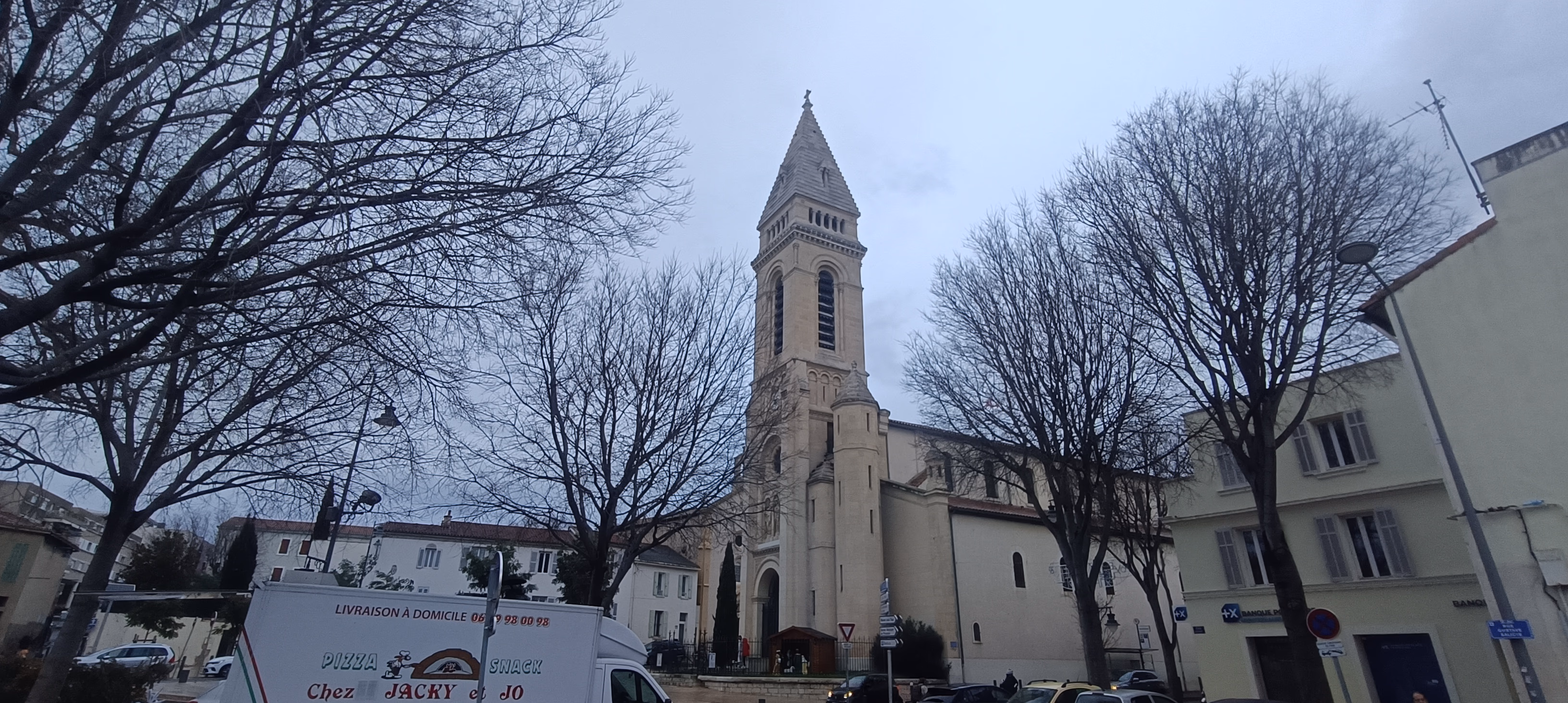
Saint-Barnabé Church, directly visible upon exiting the metro
This "village in the city" model demonstrates that high quality of life is possible without depending on cars. This configuration should inspire the opening up of other major hubs. Château-Gombert comes to mind immediately; it's a natural extension of Line 1 from La Rose that asks only to be connected to reach its full potential. Other peripheral centers (Saint-Loup, Saint-Antoine, L'Estaque) suffer from isolation. They would benefit from a similar strategy of structural networking (metro, tramway, or high-performance BRT) to stitch the city together and develop its polycentrism.

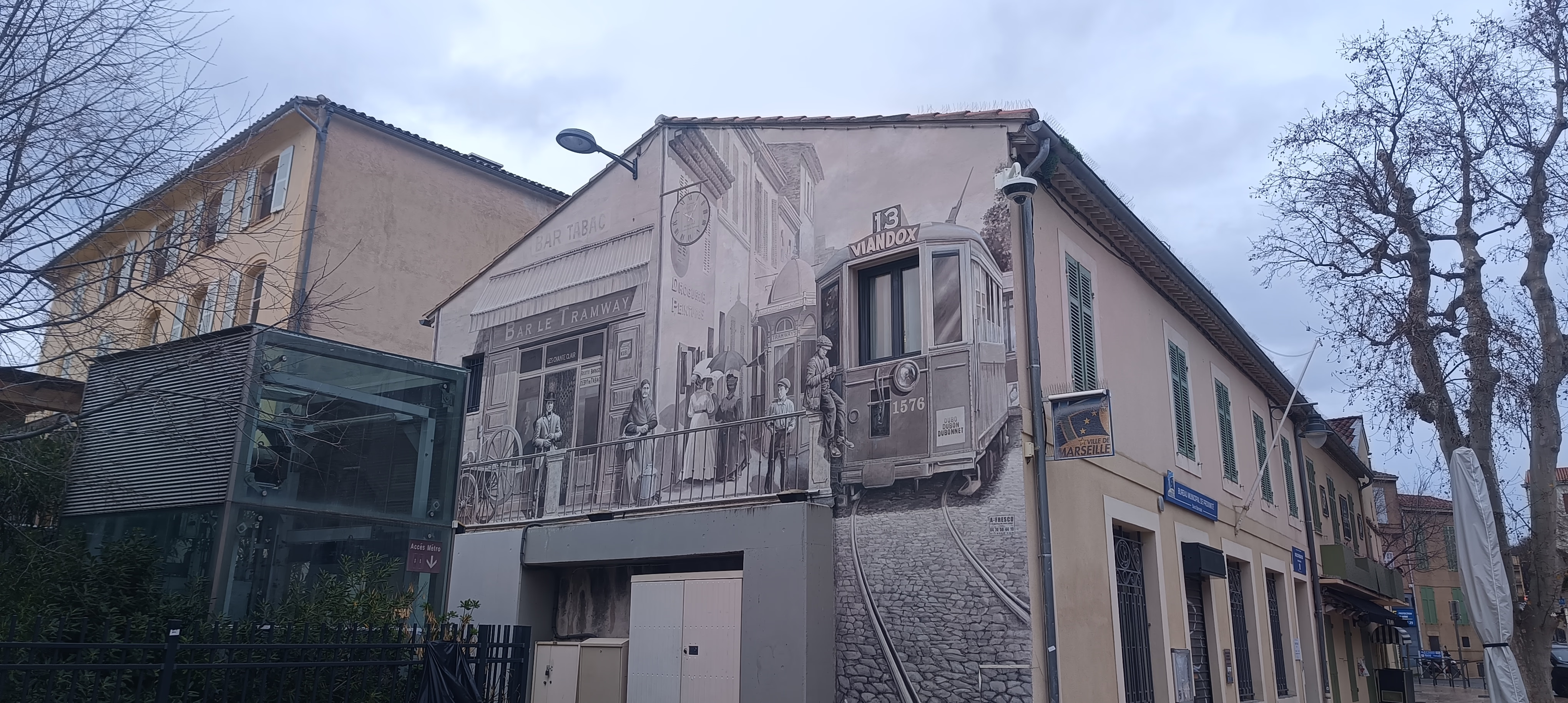
Mural showing the old tramway 13 located opposite the metro elevator access
A heritage nod: a large mural opposite the elevator, painted in an old style, shows tramway 13 of the former Marseille network.
Aubert Ganay: the tramway facing the residential citadel and its moats

The Aubert Ganay tram stop illustrates a structural line in a fragmented fabric
The arrival of the T3 tramway in the Sainte-Marguerite neighborhood highlights intense urban friction. While the infrastructure offers a rapid connection to the city center, its insertion clashes with the neighborhood's hermetic morphology. The Aubert Ganay station appears as a public island in an archipelago of inaccessible private properties.
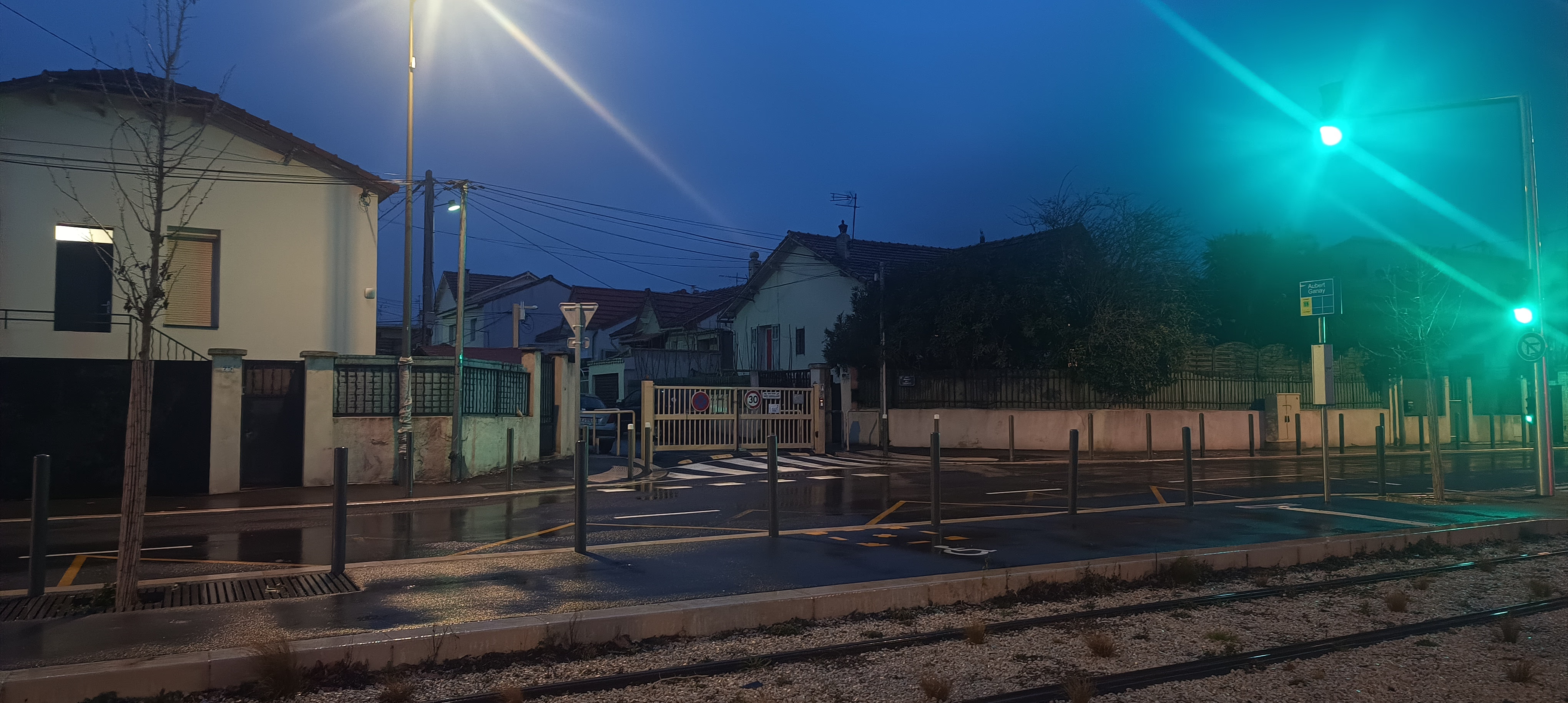
The lace of fences locking down the immediate surroundings of the station
Residential closure drastically reduces pedestrian accessibility ("walkability"). Apart from the public road corridor, transverse paths are blocked by a succession of gates. This impermeability forces residents located a few hundred meters away (as the crow flies) to make significant detours to reach the platform, effectively shrinking the station's actual catchment area.
The gate as a response to conflicts of use.
Unlike the Northern Districts where closure often responds to perceived insecurity, the logic here is one of "protecting amenities." The nearby Stade Vélodrome generates pressure (wild parking during matches) which pushes condominiums to barricade themselves. We are witnessing a defensive privatization of space that harms the fluidity of the public transport network.
Conclusion: a fragmented city slowly stitching its fabric
This photographic journey through the Marseille periphery reveals a metropolis in tension, marked by intense socio-spatial fragmentation. While renewal dynamics are undeniable, they still face strong inertia: the complex management of construction times (Bougainville), the persistence of infrastructural leftovers (Plombières), and the proliferation of residential closures—a defensive reflex in the North (Le Merlan) as well as the South (Aubert Ganay).
However, success stories exist. The example of Saint-Barnabé proves that a calmed, dense, and connected city is possible. This textbook case validates the relevance of polycentric urbanism, capable of enhancing existing village cores rather than suffering sprawl or isolation.
The challenge for operational actors (SOLEAM, Metropolis, AGAM, City of Marseille) isn't just to build facilities, but to "stitch" these disparate territories together. On the eve of the municipal elections of March 2026, accelerating Marseille's mutation will depend on public decisions moving beyond punctual treatment (the isolated project) to embrace a global strategy of networking and public space hospitality.
Sources
The following sources are in French. The titles are translated for easier reading.
-
Dario, Julien. Geography of a fragmented city: morphogenesis, road governance and impacts of residential closure in Marseille. PhD thesis, 2019. theses.fr
-
Dorier, Élisabeth and Dario, Julien. "Gated communities in Marseille: is urban fragmentation becoming the norm?", L'Espace géographique, Volume 47, 2018/4. cairn.info
-
Dorier, Élisabeth. "The city that closes / the city that collapses: methodology", Urbanicités, 2020. urbanicites.hypotheses.org
-
AGAM. Key figures from the mobility survey, 2022. agam.org (PDF)
-
Alternatives Économiques. "Gated communities fragment Marseille and separate its inhabitants", 2023. alternatives-economiques.fr
-
20 Minutes. "Marseille: 'It's a bit like our Berlin Wall'… A neighborhood walls itself off and divides inhabitants", 2025. 20minutes.fr
-
Le Monde. "In Marseille, the poorest suffer in noise hell", 2026. lemonde.fr
-
La Provence. "Marseille: Rabatau, Plombières and Gèze, what condition are the footbridges in?", 2019. laprovence.com
-
Made in Marseille. "Bougainville municipal park opens to the public", 2024. madeinmarseille.net